Projects & Initiatives
Find Projects
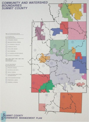
SWMD: Regional Watershed Studies
The purpose of these studies are to prepare drainage basin improvement general plans for all watershed within the Surface Water Management District. The plans will be comprehensive in nature, identifying and prioritizing specific flooding and erosion areas and providing proposed solutions and estimated costs of improvements with emphasis on defining areas of erosion mitigation and enhancement of water quality.
View project details...SWMD: Everett/Oak Hill Restoration
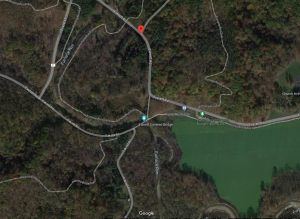
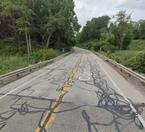
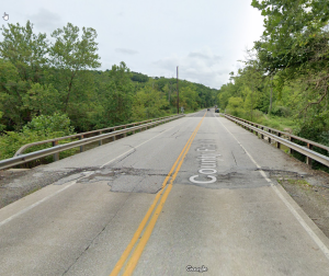
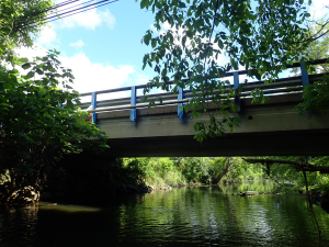
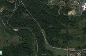
The pavement has been removed from the vacated road by Public Service and we are restoring the former County Highway a natural area in cooperation with the CVNP & Metro Parks. A bridge will be removed, and that portion of the stream will be restored to a natural condition.
View project details...Cleveland-Massillon Road Resurfacing Project, Phases I and II
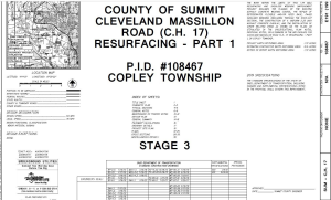
SCE has secured federal funding for the resurfacing of two sections of Cleveland-Massillon Road. In order to save time and money, we will bid and then construct the projects at the same time.
Phase I: Work includes pavement repairs, shoulder restoration and resurfacing, and pavement markings on 1.77 miles of Cleveland Massillon Road from the Norton line to 0.1 miles north of Minor Road. Located north of Brenner Road and south of Stimson Road there is a 600 foot long section of Cleveland-Massillon Road that is located between two high walls of rock cut that start immediately behind the existing curbs. Pedestrians in this area are forced to walk in the street through this corridor. This project will provide a 6 foot wide area behind the curb for use by pedestrians. Construction estimate for this section is $1.1 million.
Phase II: Work includes pavement repairs, shoulder restoration and resurfacing, and pavement markings on 1.8 miles Cleveland Massillon Road from .4 miles north of Minor to just south of E. Ridgewood Road. Construction estimate for this section is $1.17 million.
View project details...Canton Road Resurfacing - 2023 Project
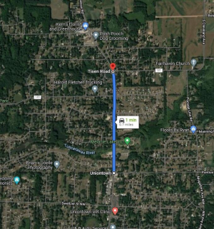
This project provides for the resurfacing of Canton Road from Pontius Road to Tisen Road. A special round of AMATS funding applications was conducted in June 2021 and SCE was awarded $528,000. This was additional STBG monies from AMATS, with an 80/20 match ratio. The money came from the Coronavirus Response and Relief Supplemental Appropriations Act.
View project details...
Construction Starts : Jul 15, 2024
Swartz Road Resurfacing Project
Resurfacing and shoulder widening of Swartz Road beginning at S. Main and ending at the Akron Corp limits, near Penguin Drive. Construction is tentatively scheduled to begin in August 2023 and last approximately 60 days. Construction was originally planned for 2025 but the funding was made available sooner so the project was moved up. The County has received $500,000 in funding from STBG Funding Program (AMATS) Estimated cost $952,500.
View project details...SWMD - Wye Road Drainage Improvements Phase 2
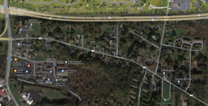
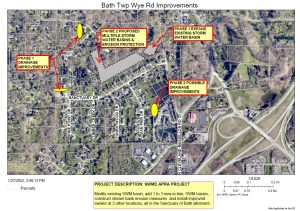
This project will be done in two phases. Phase 2 will modify existing stormwater management basins and add best management practices such as step-pools, cascades, and riffles at four locations along the stream in the ravine at the northern edge of the Sanctuary of Bath Estates It will also include cleaning out an existing storm sewer along Wye Road and perform minor clean up and erosion repairs along the stream.
View project details...SWMD: Idle Brook Bankfull Wetlands
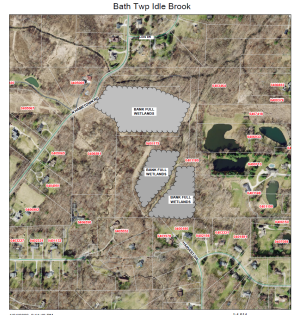
This project will construct bankfull wetlands alongside Idle Brook, Yellow Creek and West Fork to provide for up to 46 acre-feet of floodplain storage volume. This will reduce flooding downstream, reduce flow velocities in the stream (reducing erosion) and create improved habitat for flora and fauna.
View project details...SWMD: Springfield Lake Watershed Study and Upland Improvements
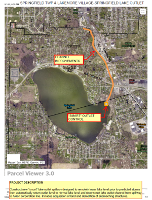
The second phase of the Springfield Lake improvements will construct stormwater basins upland of Springfield Lake to control flow and remove polutants and construct "smart" lake outlet to reduce upland flooding if warranted. Attached below are conceptual plans and water study.
The purpose of the Springfield Lake Water Quality report was to compile existing lake sampling data collected by various agencies and groups over the span of nearly 20 years. The report summarizes the data collected and provides recommendations for future sampling efforts within Springfield Lake.
View project details...SWMD: Springfield Lake Outlet, Channel Study, and Improvements
The first phase of the Springfield Lake area improvements will reconstruct Springfield Lake Outlet channel from spillway to Akron corporation line.
View project details...SWMD: Dorwick Ditch Improvements
This project will construct a retention basin and bankfull wetland north of Marwyck Dr., construct bankfull wetland along channel south of Marwyck Dr, improve channel from north of Marwick to Highland Road, and improve channel between two new wetlands then continuing southerly to Highland Road. The proposed improvements will be designed to provide proper drainage, detention, stream bank stabilization, bank-full wetlands and other water quality improvements.
View project details...SWMD: Hinman Ditch: Stormwater Basin and Channel Improvements, Ditch #52 (Penguin Area Improvements)
This project will construct 5 acres of SWM basins and/or bankfull wetlands, replace a culvert under Glenmount Ave, and improve stream channel at 2 locations: A) west of Glenmount Ave/ north of US224 and B) north and east of Penguin Apartments.
View project details...SWMD - Wye Road Drainage Improvements Phase 1
This project will be done in two phases. Phase 1 will install improved storm sewers and swales at two locations in the Sanctuary of Bath Estates.
View project details...Medina Line Bridge Replacement
This project includes replacement of the existing single span reinforced concrete slab structure carrying Medina Line Road (CR 2) over Mohler Ditch. The structure shall be replaced with a single span reinforced concrete slab with approach slab or 4-side precast box culvert. Work also includes rock channel protection, new embankment and full-depth pavement on/adjacent to structure, erosion protection, pavement marking, and minimal approach roadway work (resurfacing, drainage, guardrail, etc.) necessary to tie-in to existing. It is located just South of Johnson Rd in the City of Norton.
View project details...Minor Rd. Bridge Replacement
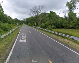
This project includes replacement of the existing single span reinforced concrete slab structurecarrying Minor Road (CR 207) over a branch of Wolf Creek. The structure shall be replaced with a single span reinforced concrete slab with approach slab or 4-side precast box culvert. Work also includes rock channel protection, new embankment and full-depth pavement on/adjacent to structure, erosion protection, pavement marking, and minimal approach roadway work (resurfacing, drainage, guardrail, etc.) necessary to tie-in to existing. It is located just West of S. Hametown Road in Copley Township.
View project details...Vanderhoof Rd Bridge Replacement
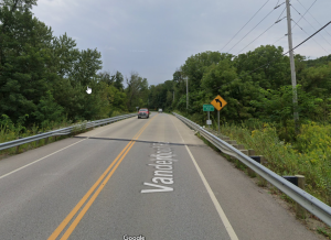
This project includes replacement of the existing single-span reinforced concrete slab structure carrying Vanderhoof Road (CR 215) over a Branch of Tuscarawas River. The structure shall be replaced with a single span reinforced concrete slab with approach slab or 4-side precast box culvert. Work also includes rock channel protection, new embankment and full-depth pavement on/adjacent to structure, erosion protection, pavement marking, and minimal approach roadway work (resurfacing, drainage, guardrail, etc.) necessary to tie-in to existing. It is located just east of Van Buren Road in New Franklin.
View project details...SWMD: Stubbins and Farnham Drainage Improvements
This project will construct wetlands and improve ditches in the Stubbins/Farnham area.
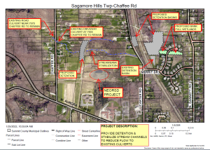
View project details...SWMD: Chaffee Road Drainage Improvements
The proposed project will provide detention and stabilize stream channels to reduce flow to existing culverts.
View project details...Canton Road and Sanitarium Road Intersection Improvement
This project will upgrade the existing traffic signal and add a sidewalk from the Springfield High School north driveway entrance to Sanitarium Road. Project work will also include additional curbing with ADA ramps, crosswalks, and pedestrian push buttons to activate the pedestrian signals.
View project details...Brecksville Road Bridge Replacement Project
This project will be a complete replacement of the Brecksville Road Bridge over Furnace Run, just east of Townsend Road in the Village of Richfield.
View project details...Granger Road Bridge (079-0221) Bridge Replacement Project
The current bridge was originally built in 1913 and received a new superstructure in 1972. The single span 65 foot long, 24 foot wide bridge will be replaced with a 87 foot long, 32 foot wide, concrete structure for vehicular traffic with wider shoulders. This project will be primarily funded with Local Bridge Program grant money.
View project details...
Construction Starts : Jul 8, 2024
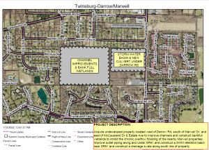
SWMD: Darrow/Marwell Drainage Improvements
The proposed project would acquire undeveloped property located west of Darrow Road, south of Marwell Drive, and east of McCausland Drive and Estate Avenue to improve channels and construct bankfull wetlands to inhibit the chronic overflow flodding the nearby Marwell properties and improve outlet piping along and under SR 91 and construct a drainage swale along south line of the property.
View project details...SWMD - ODOT I-77 Southbound Rest Area Stormwater Detention Area Improvement
The project will construct stormwater detention next to the small stream that runs north-to south near the western side of the ODOT southbound rest area property.
View project details...
Construction Starts : Sep 1, 2025
Norwood Lake Ditch
The project is located in Northfield Center Township and is a Preliminary Report for the Norwood Lake Ditch Petition in accordance with Ohio Revised Code Section 6131.
If accepted by the County Council for funding the project will investigate the need to replace over 1,100 feet of storm sewer, determine which properties benefit from the project, determine if a route for the sewer can be developed that does not cross private property, prepare a detailed construction plan and develop a detailed cost estimate for the proposed work.
View project details...NOW OPEN: Ira Road Bridge Replacement Project
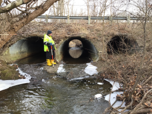
The Summit County Engineer’s Office is proposing to remove and replace the existing culvert carrying Ira Rd (CR 46) over the North Fork of Yellow Creek in Bath Township, Summit County, Ohio. The existing triple pipe culvert was built in 1959 and will be replaced with a precast concrete box culvert.
View project details...2025 Pavement Maintenance Program
The County’s Pavement Maintenance Program helps extend the life of our roads and improve driving conditions. This year’s work will include several types of maintenance on selected County roads, listed below.
Types of Road Work:
Hot Mix Asphalt (448 Resurfacing):
This is the most durable (and most expensive) paving option. Asphalt is made at a plant, delivered in heated trucks, laid on the road, and compacted with rollers. It’s ideal for roads with heavy traffic and lots of trucks because it resists wear and rutting.
Motor Paving (405 Resurfacing):
Also known as motor paving, this method uses a mobile mixing plant on-site to prepare asphalt, which is then laid and compacted. A chip seal layer (422) is applied on top afterward for added protection.
Chip Seal (422 Resurfacing):
In this method, the road is coated with a thin layer of asphalt emulsion, then covered with gravel. The gravel is compacted into place, and loose stones are swept up the same day. A second sweep is done about a week later to ensure a clean surface.
Asphalt Rejuvenation:
A special treatment is sprayed on roads paved in the last 1–2 years to restore flexibility and protect against weather damage. About 45 minutes after the spray, sand is applied to absorb excess material and improve traction. One week later, the sand is swept up.
Crack Sealing:
Hot sealant is poured into cracks in the pavement to stop water from seeping in and causing further damage.
Pavement Marking:
New road markings will be added or refreshed where needed to ensure safe driving conditions.
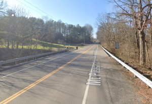
Mt Pleasant Rd. Bridge Replacement
This project will be a complete replacement of the existing 40ft wide existing structure with a prestressed box beam bridge that includes a composite deck and triple steel tube railing.
View project details...Akron-Peninsula Rd. Bridge Replacement
This project will be a complete replacement of the existing 28 ft long by 34 ft wide Akron Peninsula Rd. Bridge over Salt Run. It is located just south of Truxell Road in Boston Townhip.
View project details...W Highland Rd. Bridge Replacement
This project will be a complete replacement of the existing prestressed concrete box beam structure. It is located just east of Riverview Road in Sagamore Hills Township.
View project details...Snyder Avenue Bridge Replacement
The Summit County Engineer’s Office is proposing to remove and replace the existing bridge carrying Snyder Avenue (MR 3/CR 65) over the Tuscarawas River in the city of Barberton, Summit County, Ohio. The existing bridge was built in 1920 and reconstructed in 1963. The bridge will be replaced with a structure of similar size and alignment.
View project details...Valley View Road Landslide Repair
This project will repair two active landslide areas on Valley View Road between the Cuyahoga County line and Chaffee Road. This project will also resurface the roadway, repair roadway shoulders, improve drainage to prevent additional erosion, and install new guardrail.
View project details...Valley View Road Resurfacing Part II
Roadway Minor Rehabilitation, The existing roadway will be milled, widened, and overlaid from approximately 400 feet west of the Olde 8 Road intersection to the intersection with Dunham Road. Substandard shoulders will be widened and improved where feasible, while maintaining the existing cross slopes. Additionally, the northwest-bound approach at the North Boyden Road intersection will be widened to accommodate a revised lane configuration, including a dedicated left-turn lane.
View project details...Brady Ave. Bridge Replacement
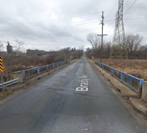
This project will be a complete replacement of the existing 72 ft long by 30 ft wide Brady Ave. Bridge over Wolf Creek. It is located between 15th St NW and 5th St NW in Barberton.
View project details...SWMD: Copley Ditch (County Ditch #38)
This project is the result of two studies described on the webpages of Copley Ditch and Black Pond Outlet Study and the Copley Meadows Study.
View project details...Glenwood Dr. Bridge Replacement
This project will be a complete replacement of the existing structure. It is located just West of Gary Drive in the city of Twinsburg.
View project details...High Level Bridge Replacement Project
The Summit County Engineer's Office has begun the long process of replacing the High Level Bridge, also known as the N. Main Street Bridge over the Cuyahoga River. This bridge is by far the largest and most expensive owned by Summit County. The current plan recommended by the Summit County Engineer’s office would replace the existing structure with a completely new structure as soon as practical, which is assumed to be 6-10 years. The all-new structure would be on an offset alignment to allow the existing structure to carry traffic while the new structure is built. There would be minimal disruption to traffic during construction. Additional right of way would be needed to construct the new structure. The new structure would carry four lanes of traffic and two sidewalks. The new structure is estimated to be a continuous weathering steel beam type structure composite with a reinforced concrete deck on reinforced concrete piers and abutments.
View project details...